Contact Us
Region 7 Block Management Program
352 I-94 Business Loop
PO Box 1630
Miles City, MT 59301
(406) 234-0930

In 2024, there are 251 Block Management Areas (BMA’s) that provide access to 2,072,698 acres of private, state, and federal lands. Similar to other FWP Regions, Region 7 (R7) has Type 1 and Type 2 BMA’s, which gives hunters flexibil ity in gaining permission. About one-third of Region 7 BMA’s are Type 1 and two-thirds are Type 2. In general, Type 1 BMA’s allow the hunter to administer their own permission, while Type 2 BMA’s require obtaining permission from the landowner or a representative. Regardless of permission type, please keep in mind that BMA’s are comprised wholly or partially of private lands. As a hunter, you have the privilege to access these lands and your behavior will play an important role in the future of Montana’s hunting access and heritage.
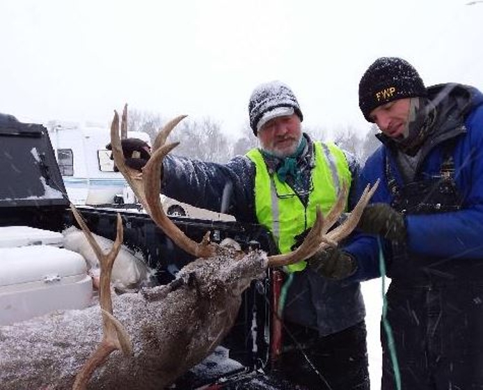
The Region 7 staff encourages hunters to share their experiences on specific BMA’s. Please return comment cards to sign-in boxes and/or mail in the self-addressed, postage paid blue comment cards. These comments are used to im prove the program as well as to show your appreciation to cooperating landowners. Pictures from your hunt are also an effective way to share your experience and can be emailed to fwpr7bmp@mt.gov. Along with comment cards, the pictures will be shared with the landowners to express your gratitude. Good luck and be safe!
Region 7 produces, on average, 30% of the state’s annual mule deer harvest; 12% of the state’s white-tailed deer harvest (22% of the total statewide deer harvest); 35% of the state’s annual antelope harvest; and 5% of the state’s elk harvest. The Region supports populations of six species of upland birds and a variety of waterfowl that provide diverse hunting opportunities.
• Antelope – Antelope are common throughout Southeastern MT (R7). Hunting Districts (HD) 701 and 705 are traditionally the more productive antelope districts.
• Elk – Isolated but expanding populations of elk exist throughout Region 7. Primary elk hunting opportunities are located in the northern portion of HD 700 as well as the southern portion of HD 704.
• Mule Deer – – Mule Deer are common throughout Southeastern MT (R7). HD 704 and 705 are traditionally the more productive mule deer districts.
• White-tailed Deer – – White-tailed deer can be found across the region associated with riparian and agricultural habitats. HD 701 and 703 offer the majority of white-tailed deer habitat.
• Upland Game Birds - Six species of upland game birds occur in Southeastern Montana. Native birds include sharp-tailed grouse, sage grouse and the migratory mourning dove. Non-native species are the ring-necked pheasant, Hungarian (gray) partridge and Merriam’s turkey. Sharp tailed grouse are well dispersed throughout the region. Pheasant numbers are generally stronger in the NE portion of the region but can be found concurrent to major riparian areas throughout the region. Turkeys are generally found across the region in association with riparian bottoms and forested areas where adequate cropland food sources exist.
• Waterfowl -- Several species of waterfowl can be found throughout the region in stock ponds, reservoirs and major river systems. Excellent late-season Canada goose hunting opportunities are present along the Yellowstone River Valley. The Yellowstone River, below the high-water mark is closed to waterfowl hunting from the mouth of the Big Horn River east to the Rosebud/Custer County line. Waterfowl hunting is legal off the river on adjacent land with landowner permission (See waterfowl regulations).
We are encouraging people to please do as much as possible over the phone: map requests, reservations, gaining permission, general block management questions, etc.
Block management maps are available to view and print on our website.
Included in the Guide is a regional map depicting the general location, identification number, and permission type for each BMA. There is also an associated chart that is organized by county and arranged in order by the BMA number. This chart gives general information for each BMA. The information in this chart will help locate the hunting opportunities you wish to pursue. It is important to recognize each BMA cooperator utilizes their own management style; this may include limits on daily hunter numbers, vehicular travel restrictions, pasture assignments, temporary closures, etc... The following outlines the procedure to request additional information for individual BMA’s:
Refer to the map and chart to identify individual BMA’s you are interested in hunting. Note: The chart lists ‘Primary Hunting Opportunities’. This is intended to assist hunters in selecting a BMA that fits their desired hunting opportunity. In contrast, for a BMA that does not list a particular commission-authorized game species, the omission of that species is not intended to represent that those game species may not be found or may not be hunted on that particular BMA. ‘Primary Hunting Opportunity’ information should be used as a general reference regarding game that is most likely to occur on the BMA. BMA’s that have a formal species restriction in place will have such a restriction noted in the ‘Additional Information’ column. It is important to note that Block Management cooperators may exercise their discretion in managing the hunting on their property in response to environmental conditions and game numbers.
If you select a Type 1 BMA… Rules/maps can be obtained onsite at the hunter sign-in boxes or in person at the Regional office in Mils City.
If you have selected a Type 2 BMA…Using the BMA number, request landowner contact information from the Fish, Wildlife & Parks Region 7 headquarters in Miles City. Individual landowner contact information may be obtained in person at 352 I-94 Business Loop, by e-mailing fwpr7bmp@mt.gov or by calling (406) 234-0930.
If you need more specific information about a BMA to assist in your planning efforts, a complete set of R7 BMA maps will be available for viewing at the Regional headquarters. Hunters are allowed to receive a maximum of five maps per day. Please help us reduce administrative costs by only requesting the maps of BMA’s you intend to visit.
Individual BMA rules/maps will also be available for viewing/printing on the FWP website.
How to Obtain Permission to Hunt R7 BMAs
Again, Type 1 BMA’s are hunter administered (see step 2 above). For Type 2 BMA’s, landowner contact information will be given for up to 5 BMA’s per phone inquiry. Contact information usually consists of the name and phone number of the person(s) with authority to grant permission. When you are contacting landowners to secure permission to hunt, please abide by the specified calling times for the cooperator. When call times are not specified, please call between 7:00 AM and 9:00 PM Mountain Time. Due to the volume of calls received, landowners are not required to and should not be expected to return phone calls. While obtaining permission to hunt BMA’s within R7, please keep the following administrative rules/policies in mind:
Use only current year BMA rules/maps. R7 produces new rules/maps each year to address rule, boundary, or permission method changes. Also, there is some turnover in BMA’s from year to year, therefore a BMA from a previous year may no longer be enrolled.
Reservations may not be made before August 22nd. If a BMA takes reservations, a hunter may only have 1 reservation on that BMA at any one time. After the dates of the reservation pass, a hunter may make another reservation to hunt that BMA. Hunters may have reservations on more than one BMA as long as they are not for the same hunting dates. Reservations can be up to 3 days, but must be for consecutive days. Individuals from the same hunting party may not make reservations for consecutive 3-day blocks in an attempt to book more than 3 days for their party. Hunters may hunt more than one BMA in a day, but are prohibited from making reservations to hunt on more than 1 limited-hunter BMA per day.
Approximately 10% of the total land base in FWP Region 7 is enrolled in the Block Management Program, leaving a substantial amount of land and associated hunting opportunities for hunters to explore. As a result, hunters are encouraged to consider these alternative opportunities and not limit their hunting activities to only Block Management Areas.
Private Lands NOT Enrolled in Block Management
Region 7 is comprised of primarily private land (76%). Although the region has 253 BMA’s enrolling approximately 1.54 million private acres (8%) of the 19.2 million acres of private land in Region 7, hunting access can often be obtained on non-Block Management private property throughout much of the region by respectfully asking for hunting permission. Always remember to “Ask for Access” before hunting on private land.
Public Lands
In Region 7, there are over 3.8 million acres of public ownership (BLM, State Lands, National Forest Service and National Wildlife Refuge). This assortment of public land constitutes a land base composition of 18% federal land and 6% State of Montana Department of Natural Resources (DNRC) land. Public lands are accessible via public roads or waterways, adjacent public land and adjacent private land with landowner permission. Hunting activities on federal lands are subject to both state and federal regulations. Some legally accessible tracts of Department of Natural Resource Land (State School Trust Land) are formally enrolled in the Block Management Program. Formally enrolled State Land must be posted with contact information for the method of obtaining permission. If a BMA contains formally enrolled State Land, it will be noted in the Access Guide and on the map. Please contact regional FWP staff to verify accessibility and use rules for accessing public lands contained within BMA boundaries.
FWP administers Wildlife Management Areas (WMAs) throughout the region, each of which provides some hunting opportunities. WMAs in the region include:
WMA maps available online in our Hunt Planner
FWP also administers numerous Fishing Access Sites (FASs) and State Parks (SPs) throughout the region that provide some hunting opportunities. These sites include:
Myer’s Bridge FAS: 49 acres, no weapons restrictions
Far West FAS: 34 acres, archery and/or shotgun only
Twelve Mile Dam FAS: 27 acres, waterfowl/upland game bird season only, shotgun only
Kinsey Bridge FAS: 28 acres, archery and/or shotgun only
Bonfield FAS: 56 acres, archery and/or shotgun only
Fallon Bridge FAS: 6 acres, archery and/or shotgun only
South Sandstone FAS: 581 acres, archery and/or shotgun only
Stipek FAS: 119 acres, archery and/or shotgun only
Intake Dam FAS: 405 acres, archery and/or shotgun only
Johnson Reservoir FAS: 30 acres, no weapons restrictions
Elk Island FAS: 69 acres, no weapons restrictions
Seven Sisters FAS: 8 acres, no weapons restrictions
Gartside Reservoir FAS: 159 acres, no weapons restrictions
Diamond Willow FAS: 80 acres, no weapons restrictions
Pirogue Island SP: 269 acres, archery and/or shotgun only
Medicine Rocks SP: 330 acres, no hunting around campgrounds & developed areas
Makoshika SP: 11,538 acres, contact the park for hunting regulations and restrictions
Rosebud Battlefield SP: 4,220 acres, no weapons restrictions
Tongue River Reservoir SP: 642 acres, archery and/or shotgun only
Maps available online in our Hunt Planner
Other public hunting opportunities include:
Tongue River Ranch (DNRC): 20, 979 acres, southwest of Miles City
Pumpkin Creek Ranch Recreation Area (BLM): 21,206 acres, south of Miles City
Knowlton Travel Management Area (BLM): 15,000+ acres, east of Knowlton
Hay Draw Travel Management Area (BLM, DNRC, FWP): 30,000+ acres, east of Broadus, road open July 1st – December 15th
Maps available at the Region 7 FWP office in Miles City
352 I-94 Business Loop
PO Box 1630
Miles City, MT 59301
(406) 234-0930