In 2024, there are 156 Block Management Areas (BMAs) that provide access to 1,301,241 acres of private and isolated public land. Hunters will find Region 4 Block Management Areas to be diverse in habitat, available game animals, and hunting opportunity.
Habitat/Terrain
Comprised predominantly of the Northwestern Glaciated Plains and Great Plains, the landscape transitions from sagebrush steppe, prairie grasslands, and agricultural production acreage at low elevations to montane grassland and conifer-dominated forest at higher elevations.
How to use Region 4 BMP
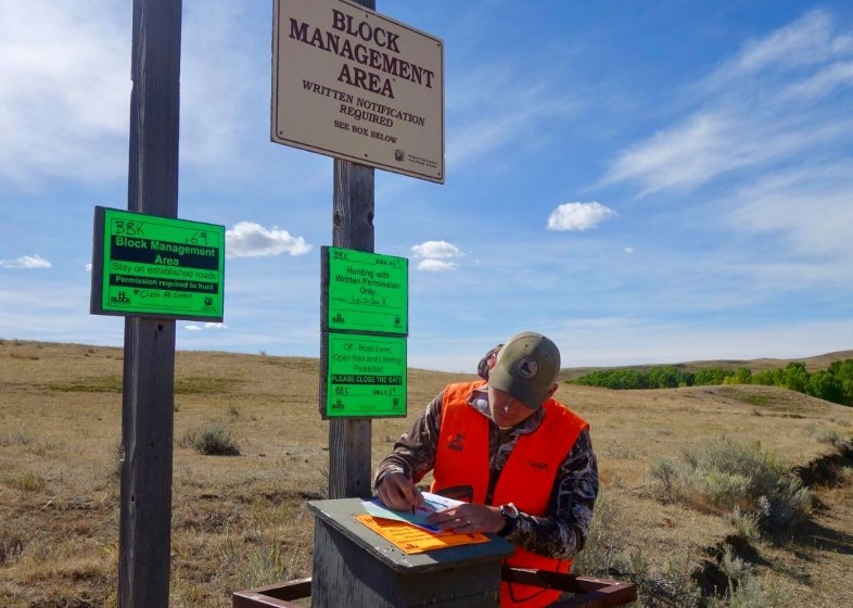
Each BMA has access requirements and hunting use rules specific to that BMA. These rules and access requirements will be listed on the back of each individual Region 4 BMA map. To hunt ANY BMA in Region 4, a hunter (at least one hunter in a group) must first obtain a BMA map from FWP. Maps are valid from 1 September through January 1 of each year. Check the data contained in the annual Hunting Access Guide each year to see if a previously issued map is still current or if a new map is required. Lands are only enrolled in Block Management for the FALL hunting season (September 1–January 1).
The only valid and authorized BMA maps are provided free of charge from either the cooperator direct or from an FWP office. NO OTHER SOURCE(S) ARE AUTHORIZED TO DISTRIBUTE BMA MAPS. Failure to abide by the rules and procedures specified either in the regional guide or on the BMA map violates the conditions of the cooperative agreement between FWP and the landowner, and may result in denial of future access to the BMA and/or citations being issued.
Region 4 landowners are very concerned about noxious weeds. Hunters should ensure vehicles, clothing, and animals are free of mud and debris that may contain weed seeds. Landowners may deny access to hunters driving excessively muddy vehicles that pose a risk of noxious weed introduction.
BMA reservations may not be accepted before August 22.
For BMA information, including information about BMA closures, contact the Region 4 Block Management Office by calling (406) 454-5862, Monday through Friday, 8:30 AM to 4:30 PM, or via the R4 BM e-mail address: fwpr4bmp@mt.gov.
ADDITIONAL HUNTING OPPORTUNITIES IN REGION 4
In Region 4, there are over 4.6 million acres of public ownership (Bureau of Land Management, Forest Service, State Lands, and National Wildlife Refuge). This assortment of public land constitutes a land base composition of 18% federal land and 7% State of Montana Department of Natural Resources and Conservation (DNRC) land. These parcels of public land are accessible via public roads or navigable waterways, adjacent public land, and adjacent private land with landowner permission.
FWP administers Wildlife Management Areas (WMAs) throughout the region; each of which provides a culmulative 109,770 acres of hunting opportunity. WMAs in the region include:
Beartooth WMA: 35,174 acres, northeast of Wolf Creek
Beckman WMA: 6,639 acres, northeast of Denton
Blackleaf WMA: 10,754 acres, west of Bynum
Ear Mountain WMA: 3,047 acres, west of Choteau
Freezout WMA: 11,333 acres, north of Fairfield
Judith River WMA: 9,408 acres, south of Utica
Marias River WMA: 8,865 acres, southwest of Shelby
Smith River WMA: 3,527 acres, north of White Sulphur Springs
Sun River WMA: 21,023 acres, west of Augusta
Hunters should be aware of seasonal WMA closures to protect wintering wildlife and consult individual maps for additional WMA rules and regulations. WMA maps are available online at https://fwp.mt.gov/gis/maps/huntPlanner/
FWP also administers numerous Fishing Access Sites (FASs) and State Parks (SPs) throughout the region that provide some hunting opportunities. These sites include:
Spite Hill FAS : 13.5 acres, centerfire and rimfire rifles prohibited
Eagle Island FAS : 22 acres, no weapons restrictions
Pelican Point FAS : 94 acres, archery, shotgun, pistol, and muzzleloader only
Wing Dam FAS : 25 acres, centerfire and rimfire rifles prohibited
Little Muddy Creek FAS : 3 acres, no weapons restrictions
Dunes FAS : 61 acres, centerfire and rimfire rifles prohibited
Reed and Bowles FAS : 50 acres, centerfire and rimfire rifles prohibited
Hruska FAS : 52 acres, centerfire and rimfire rifles prohibited
Lower Carter Pond FAS : 7 acres, archery and waterfowl hunting only
Upper Carter Pond FAS : 5 acres, archery and waterfowl hunting only
Martinsdale Reservoir FAS : 336 acres, no weapons restrictions
Ackley Lake SP: 42 acres, archery and shotgun hunting only
First Peoples Buffalo Jump SP: 2228 acres, archery and shotgun hunting only
Giant Springs SP: 733 acres, archery and shotgun hunting only
Sluice Boxes SP: 1323 acres, no restrictions
Tower Rock SP: 148 acres, archery hunting only
Hunters planning on hunting Fishing Access Sites and State Parks should thoroughly review individual site rules and maps. Additional restrictions and area closures may be applicable. FAS and SP maps are available online at https://fwp.mt.gov/gis/maps/huntplanner/
FWP manages hunter-use on several Conservation Easements (CEs) totaling 13,956 acres in Region 4.
Bird Creek Ranch CE: 2292 acres, reservations required
Chokecherry Bend CE: 801 acres, reservations required/ rifles prohibited
Harris Land and Cattle CE: 10,013 acres, reservations required
Hunters planning on hunting Conservation Easements should obtain and review individual maps for additional rules and permission requirements. CE maps are available online at https://fwp.mt.gov/gis/maps/huntplanner/.
Contact Us
Region 4 Block Management Program
4600 Giant Springs Road
Great Falls, MT 59406
(406) 454-5862
Lewistown Area Office
(406) 538-4658 ext. 22
Block Management Regions
Each region has BMA maps available for distribution. Information can be found below or in each of the regional sections of the Hunting Access Guide.