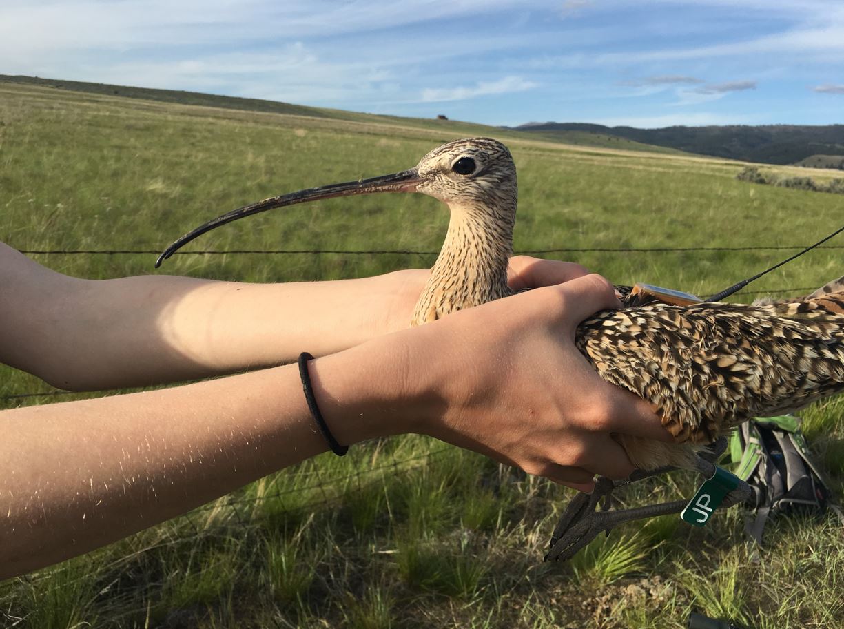

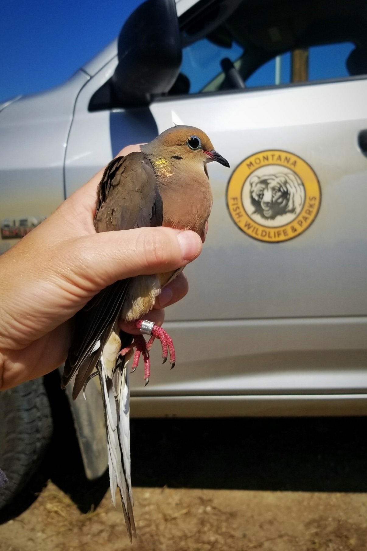
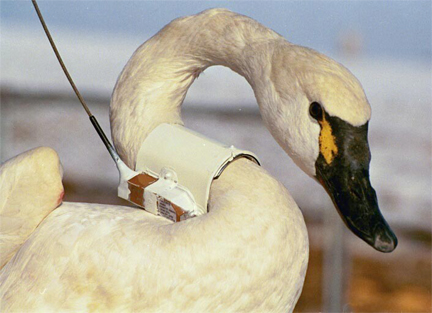
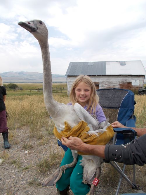
Tracking collars and tags are commonly used to monitor wildlife and allow researchers and managers to collect information on wildlife ecology including: home and seasonal ranges; habitat use; species interactions; and movement patterns including migration, behaviors, mortality, and diet. Collar and tag technology has evolved over time, moving from very high frequency (VHF) transmitting devices that emit a pulsed radio signal allowing biologists to track marked individuals, to global positioning system (GPS) devices that store locations in the device for future download. GPS is a navigation system that operates using an array of satellites to identify location, speed, and time data. A GPS device on the ground communicates with all available satellites to produce the device’s location and time. The most recent advancement is satellite GPS devices that collect location data using GPS satellites and then transmit the data to a communication satellite (e.g., Iridium, Argos) that relays the information to a user or online account where it can be downloaded at any time. Some companies offer interactive user interfaces that allow for mapping, downloading, and direct communication with devices via a website. Satellite devices are available for a range of species and can be attached permanently or with a drop-off mechanism that releases the device on command or after a preset period of time (e.g., one year). Additional sensors that detect activity, temperature, and mortality are also available.
GPS data collection can be targeted to answer specific research or management questions by adjusting what time of year data are collected and how frequently locations are recorded. If fine-scale movement data are needed to define migration routes or map calving grounds, then locations can be recorded frequently (e.g., every 30 minutes) during the time of year when those behaviors are most likely to occur. Outside of that time period, locations can be recorded at larger intervals (e.g., four hours) in order to prolong the device battery and extend the length of time they can be deployed on that animal. The battery life of current satellite collars deployed on large ungulates (e.g., elk, deer) allows for hourly locations for three years. Devices deployed on small animals such as birds or bats do not have long battery life as the size of the battery is much smaller. These devices can work for just a few weeks. Larger birds like eagles however can carry devices that collect daily locations and last for multiple years. Many of the bird and bat devices are designed to fall off after a time as they may be glued to the animal or attached with a harness designed to deteriorate over time.
While a GPS device only needs three satellites to identify its location, accuracy is improved with a larger number of satellites. Physical obstructions such as mountains and trees can decrease accuracy by bouncing the signal or limiting the number of satellites a device can communicate with. Collars with a clear view of the sky in open terrain are typically accurate to a few meters. Devices attached to bats can be notoriously difficult to track as these animals often roost in rocks where signals are lost.
Improving technologies have allowed for even the smallest of animals to be radio marked. LifeTag and NanoTag are two types of radio transmitters that can be attached to birds and bats with small harnesses or glue. These tags are part of an automated tracking system known as MOTUS. Motus is Latin for movement, or motion. The MOTUS Wildlife Tracking System is an international collaborative research network that uses a coordinated automated radio telemetry array to track the movement and behavior of small flying animals. Researchers can fit small lightweight radio-transmitters on birds, bats, and large insects such as monarch butterflies. The device signal is detected by receivers scattered around the landscape. Each tag emits a unique signature so researchers can determine where animals go, how fast they move between points (migration ecology), and how long they stay in an area (stop-over ecology). The purpose of MOTUS is to facilitate landscape-scale research and education on the ecology and conservation of migratory animals. One of the central objectives of MOTUS is to enable conservation and ecological research by providing a way to track the movement of animals.
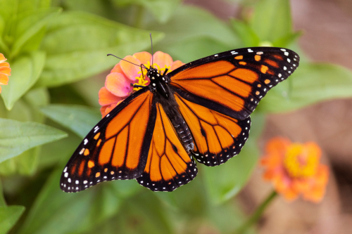 If you think you can outpace a dragonfly, think again. Researchers from the University of Guelph used radio transmitters to track the migratory flights of monarch butterflies and green darner dragonflies. They found that while, on average, the dragonflies flew about 16 kilometres per hour (9.9 miles/hour), the fastest was clocked at a groundspeed of 77 kilometres per hour (47.8 miles/hour) with tailwind assistance. Monarch butterflies flew at an average speed of 12 kilometres per hour (7.4 miles/hour), with the top monarch moving at 31 kilometres per hour (19.2 miles/hour) with tailwind assistance. The study also estimated how far the insects travelled in a day and found that higher temperatures and wind assistance resulted in faster travel times. The results from this research study, the first of its kind, show how innovations in radio-tracking technology can help researchers understand the movement of insects across the globe.
-- CottageLife, Grace Hunter, July 16, 2019
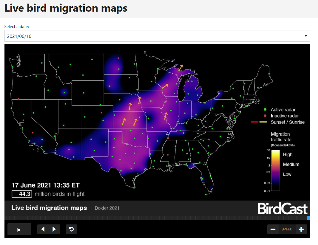
BirdCast applies weather surveillance radar to gather information on the numbers, flight directions, speeds and altitudes of birds aloft in order to expand the understanding of migratory bird movement. Visit birdcast.info for more information.